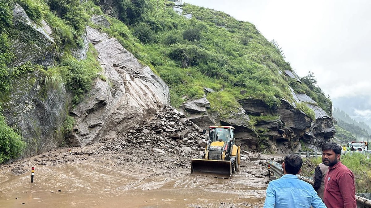
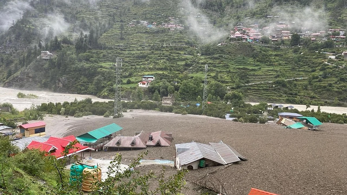
Uttarkashi: The devastating flash flood that swept through Dharali village in Uttarkashi district on Tuesday was not caused by a cloudburst, scientists have clarified. Contrary to initial assumptions, the India Meteorological Department (IMD) recorded only 8 to 10 mm of rainfall in the area on August 4–5, far below the 100 mm threshold typically associated with a cloudburst.
According to the Meteorological Department, Harsil recorded 9 mm of rainfall and Bhatwadi 11 mm on Tuesday. "With such low rainfall, the possibility of a cloudburst is highly unlikely," said Dr S P Nag, a meteorologist said.
Officials also noted that some people are speculating about the likelihood of a major event such as a landslide lake outburst flood (LLOF), similar to the one that occurred in 1978 at Kanauldiya Gad, a few kilometers before Harsil.
Experts second this view and believe the disaster was likely triggered by the sudden collapse of a temporary lake formed by a landslide, a glacial burst, or a flash flood. “Dharali lies in a floodplain and is surrounded by dense forests and snow-covered mountains. The nature and speed of the water flow do not match the pattern of a cloudburst,” Dr. D.P. Dobhal, former scientist at the Wadia Institute of Himalayan Geology, told select group of reporters.


Dr. Dobhal pointed out that the Khir Ganga stream, which overflowed during the incident, flows through these forests and originates from snow-clad mountains. “The speed and volume of the floodwater indicate a sudden breach—either of a temporary lake formed due to landslide blockage or a glacial ice mass collapsing into stagnant water,” he said.
He also compared the disaster to the 2013 Kedarnath tragedy, when the collapse of the Chorabari lake led to massive flooding. “Rainfall typically does not occur at altitudes of 3,000 to 4,000 meters. But due to climate change and rising temperatures, rainfall patterns are shifting,” he warned.
In Dharali’s case, the video footage suggests that the flood was caused by a sudden release of water laden with dark silt and debris—signs often associated with the bursting of an ice-dammed lake or a glacier fall into pooled water. Dr. Dobhal noted that this was similar to the 2021 Rishiganga disaster in Chamoli district, where debris from a temporary lake came crashing down.
Dr. Manish Mehta, senior scientist at the Wadia Institute, said the exact cause of the Uttarkashi disaster can only be confirmed after satellite images are analyzed. “Our past research suggests three or four possible causes: a glacial lake outburst, collapse of a landslide-formed temporary lake, or flash flooding,” he said.
Dr. Vineet Kumar Gahalaut, Director of the Wadia Institute of Himalayan Geology, echoed this view: “Until satellite imagery is available and scientific teams survey the site, we can’t pinpoint the exact cause. But based on initial evidence and past patterns, glacier collapse, breach of a temporary lake, or a flash flood seem to be the most likely explanations.”
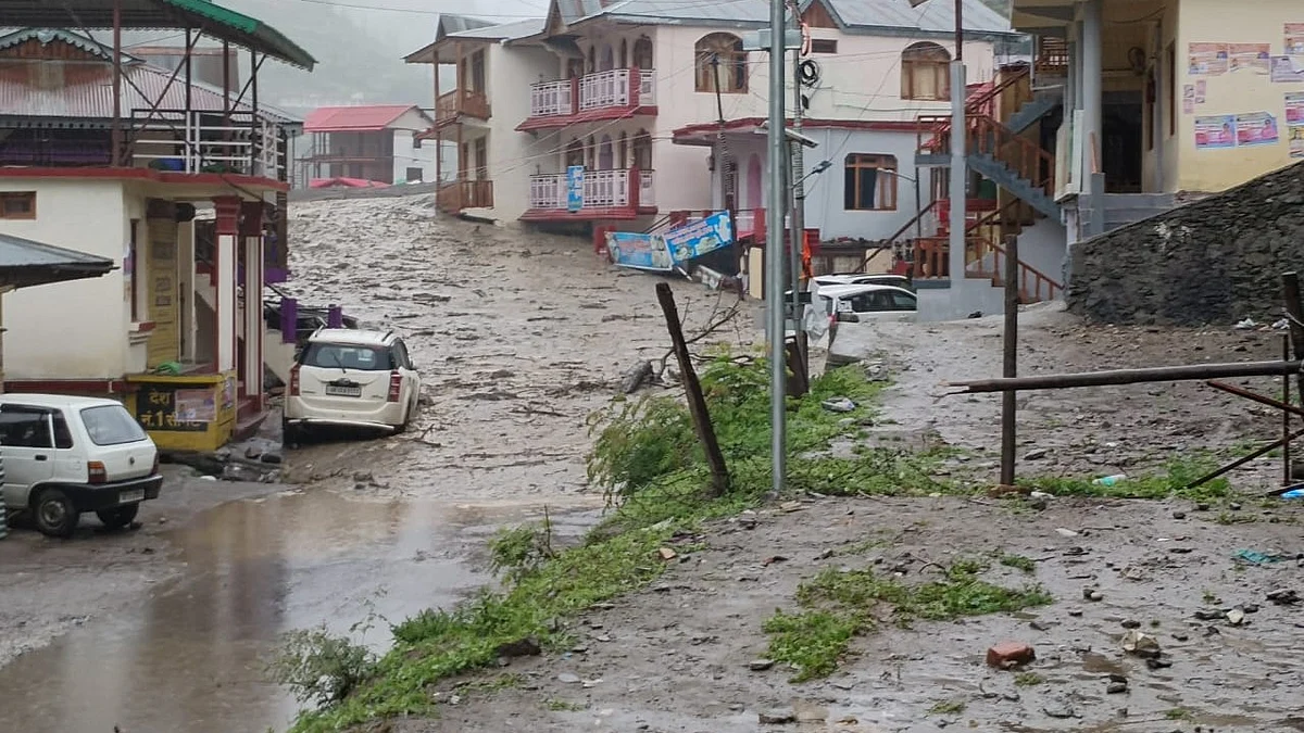
Experts also highlighted the vulnerability of the region due to its narrow valleys, steep slopes, and the increasing impact of climate change. The sudden deluge, loaded with loose material such as ice, boulders, sand, and gravel, supports the theory that a natural dam gave way high up in the mountains.
As the search and rescue operations continue, geologists and scientists are preparing to conduct on-ground assessments and satellite-based analyses to understand the full extent and cause of the tragedy.